
Sinclair Head to Seatoun
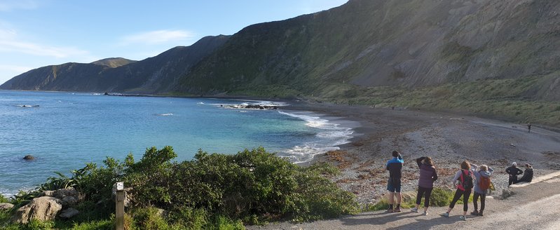
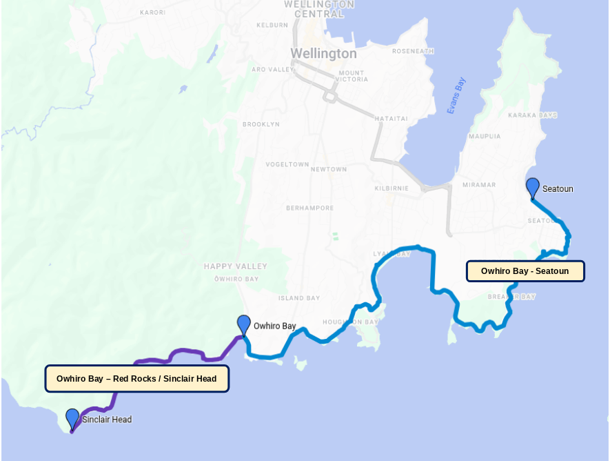
This extended route of the Great Harbour Way is well worth doing, as you will experience stunning scenery along the wild south coast and at the harbour entrance. The first part involves a return trip from Owhiro Bay to Sinclair Head, after which you will follow several beautiful bays before arriving at Eastbourne.

Route Map
Distance: 23½km
🚶 Average walking time: 5 hours
🚲 Average cycling time: 1½ hours
Surface: footpaths, gravel tracks, on-road cycling
Typical starting point is Owhiro Bay (directions)
⛰ Minor hilly sections
🚌 Bus access
☕ Various cafes between Owhiro Bay and Lyall Bay
🚻 Toilet and water facilities along some of the route
Some swimming beaches
Note that cyclists will need to be on the road for parts of this route.
Route Sections
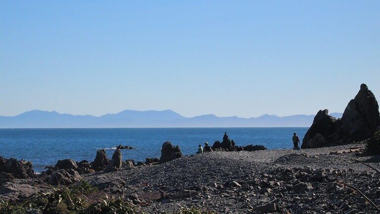
Located on the south coast, the spectacular Red Rocks trail is open to walkers and bikers, and recreational four-wheel drivers (except on Sundays). The gravel can be loose and deep in some places, making it hard going, especially for cyclists.
This wild shoreline with its fascinating rock formations makes for a fantastic round trip. In the winter you can see fur seals basking on the rocks near Sinclair Head. Keep a distance, and dogs must be on a leash.
7½km (return trip)🚶 3 hours to walk
🚲 1 hour to bike
Surface: footpath and on-road cycling to start with, then gravel track
⛰ No hills
🚌 Bus stop by start of the route
🚻 Toilet and water facilities at the visitor centre
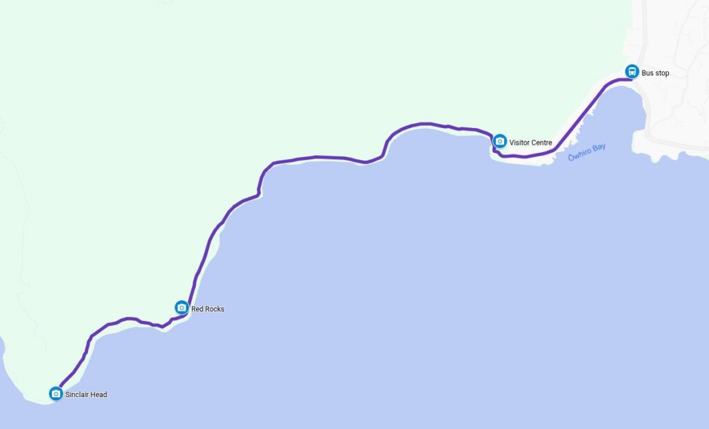

Check out the displays of the south coast history and ecology. Toilets and water facilities here.
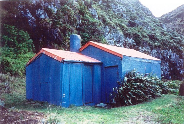
Baches built between 1900 and 1907 as part of the Owhiro sheep station, preserved as historic structures.

Ancient 200-million-year-old pillow lava outcrops featuring distinct red iron-oxide coloring
Devils Gate

[Sourced from WellingtonNZ / @RoadyNZ]
A narrow rock cutting close to the seal colony. Fun watching 4-wheel trucks trying to get through here.
Sinclair Head – Seal colony
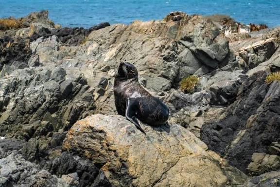
Meet the seals in winter just beyond Sinclair Head but keep your distance.
| Bus | Take the #39 Island Bay bus from Wellington to stop 6153 at Owhiro Bay |
From Owhiro Bay you will travel along the beautiful Island Bay, Houghton Bay, Princess Bay, and Lyall Bay. Some of the bays are good spots to swim on warm sunny days, although the water along the south coast never gets warm! Enjoy the ever-changing scenery and treat yourself to something nice at one of the cafes you come across.
7 kilometres
🚶 Average walking time: 1½ hours. Mostly on footpaths. Also tracks.
🚲 Average cycling time: ½ hour. All on-road.
☕ Various cafes along the way
🚻 Toilet and water facilities along the way
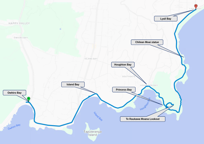
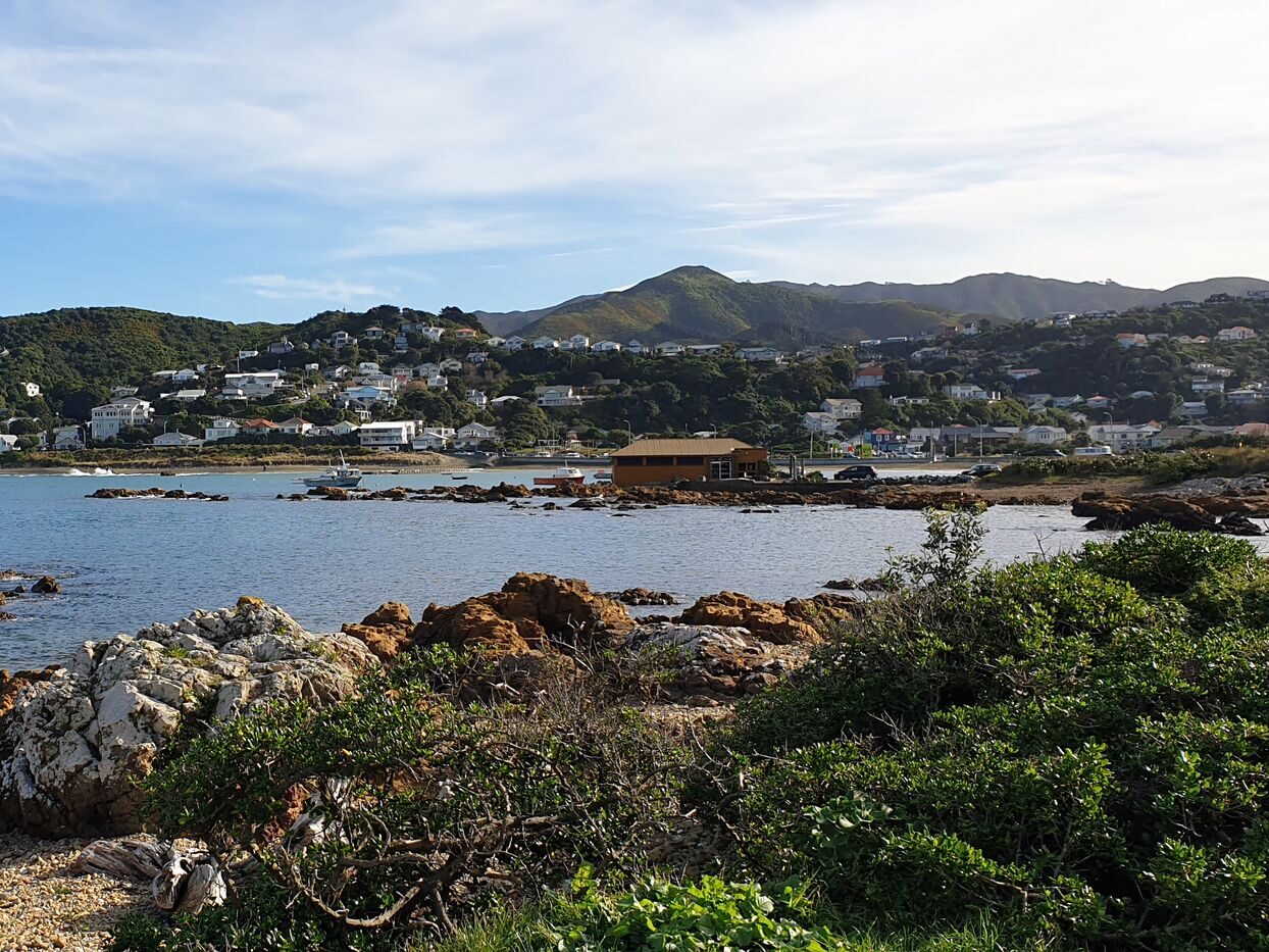
A popular coastal suburb. This sandy south-coast beach is popular for swimming, diving, and snorkelling. Its name refers to the Tapu Te Ranga Island.
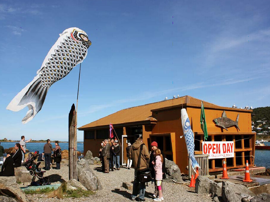
All the marine life from the Wellington region on display, plus the “Touch Gently Pool”, where you can gently hold some of the marine animals. Open on Sundays only.
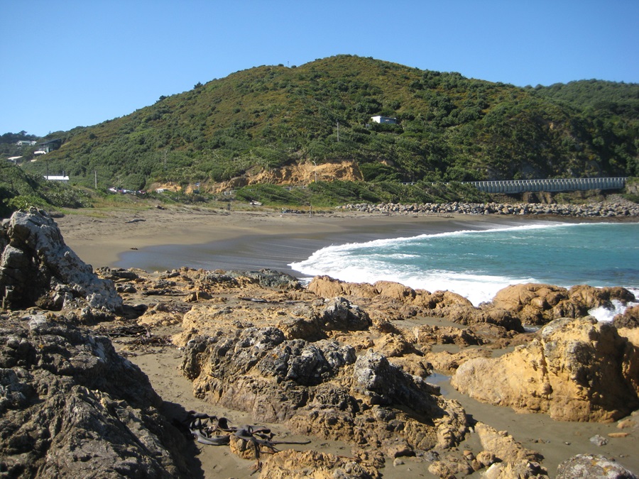
Houghton Bay is a popular surfing beach because of its big southern swells. Whereas Princess Bay is popular for swimming as it is sheltered.

Take the steep walk up the hill at Princess Bay to this wonderful lookout and be rewarded with amazing views over the Cook Strait and the Wellington Harbour.
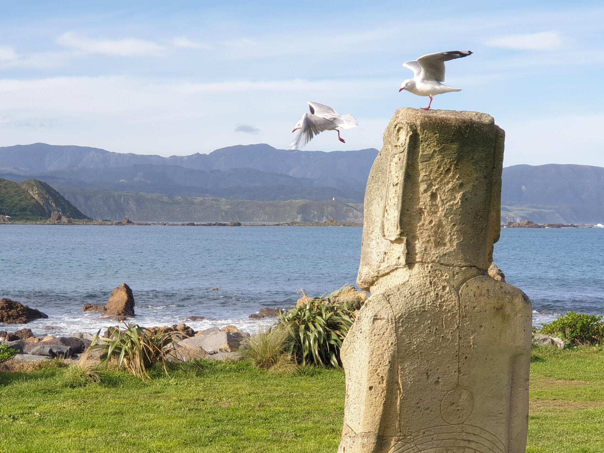
This 3.2-tonne Hinuera stone moai was a gift from Chile to represent its friendship with New Zealand. It stands alone on the south Wellington Coast, looking out to sea.
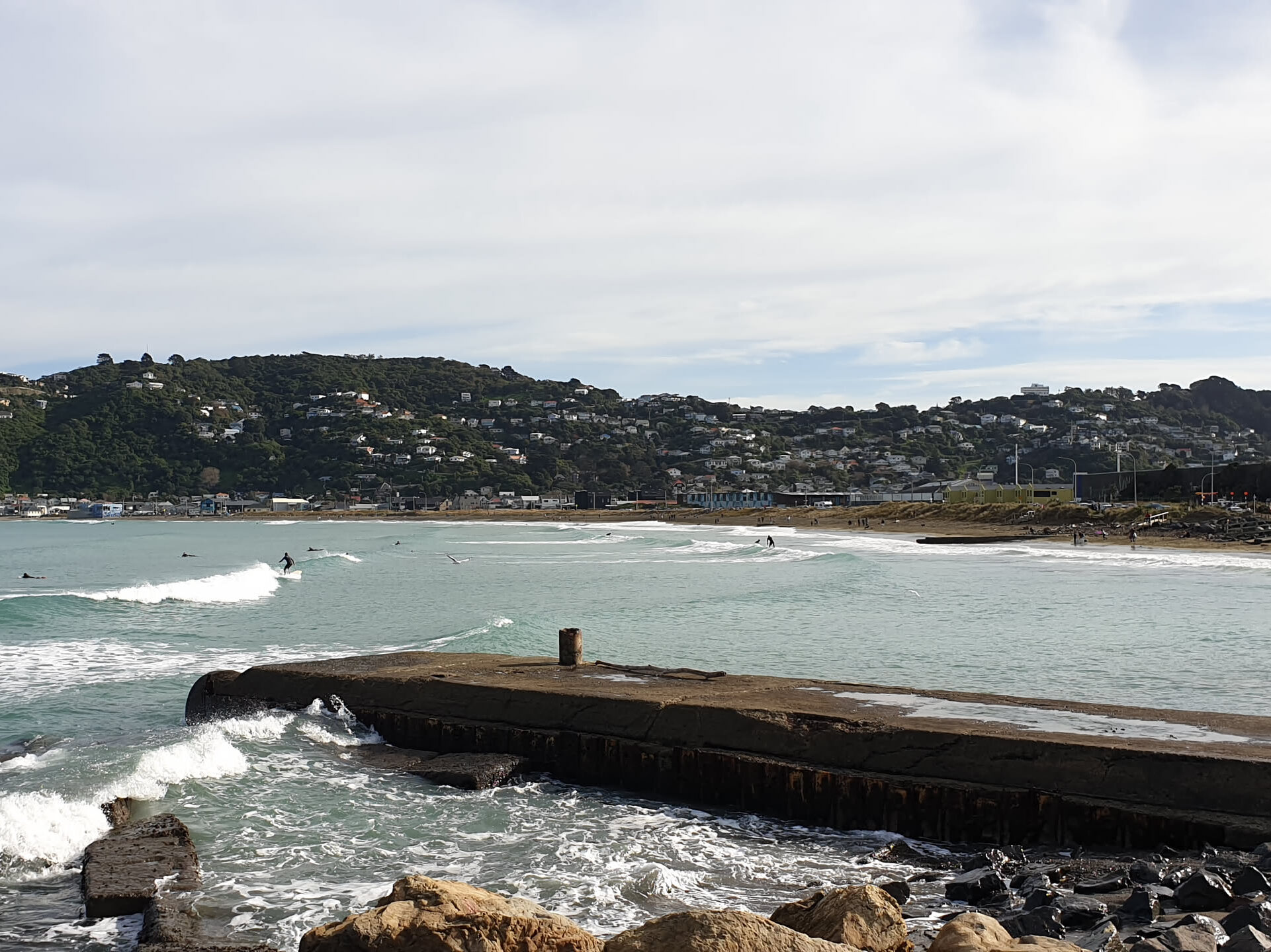
This popular coastal suburb has a wonderful swimming and surfing beach plus a great selection of fantastic cafes. Good view of planes taking off and landing at the Wellington airport.
Beach House & Kiosk Cafe
410 The Esplanade, Island Bay
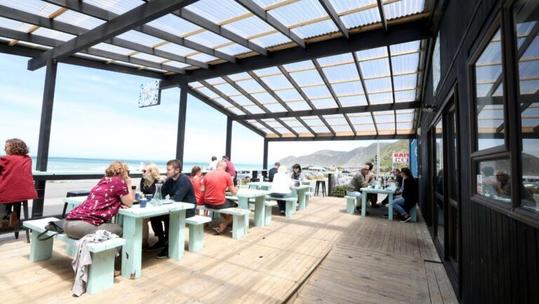
A relaxed coastal spot sitting right on The Esplanade in Island Bay. Offers stunning sea views, excellent coffees, cabinet treats, and a full brunch menu.
Google reviews: 4.5 stars
Price per person: $20-30
Hours: 8:30am-3:30pm Tue-Sun
Maranui Cafe
L1, 7A Lyall Parade, Lyall Bay
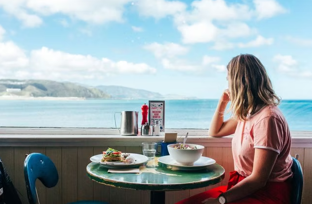
This iconic Wellington cafe, upstairs in the historic red-and-white surf lifesaving club building at Lyall Bay, is famous for its food and views of the surf and the nearby airport.
Google reviews: 4.5 stars
Price per person: $20-30
Hours: 7am-4pm Mon-Thu, 8am-4pm Sat-Sun
The Botanist Cafe
29 Onepu Road, Lyall Bay

Situated just off the main beach parade in Lyall Bay, this café specialises in plant-based, vegetarian, and vegan cuisine. Features a sunny sheltered courtyard.
Google reviews: 4.3 stars
Price per person: $20-30
Hours: 10am-10pm Mon-Fri, 9am-10pm Sat-Sun

Start the day with a walk around the south side of Wellington Airport, then continue to Tarakena Bay, where you can take a walk up the hill to the Atatürk Memorial and admire the views. After that, it is on to Breaker Bay. As you go up the hill, take the Fort Dorset track on your right. Check out the old WWII fortress and the beautiful waka sculpture at the Oruaiti Reserve. From there it is on to the Seatoun Wharf via the Wahine Memorial Park.
9 kilometres
🚶 1½ hours to walk. Mostly on footpaths. Also tracks.
🚲 ½ hour to bike
🚻 Limited toilet and water facilities along the way
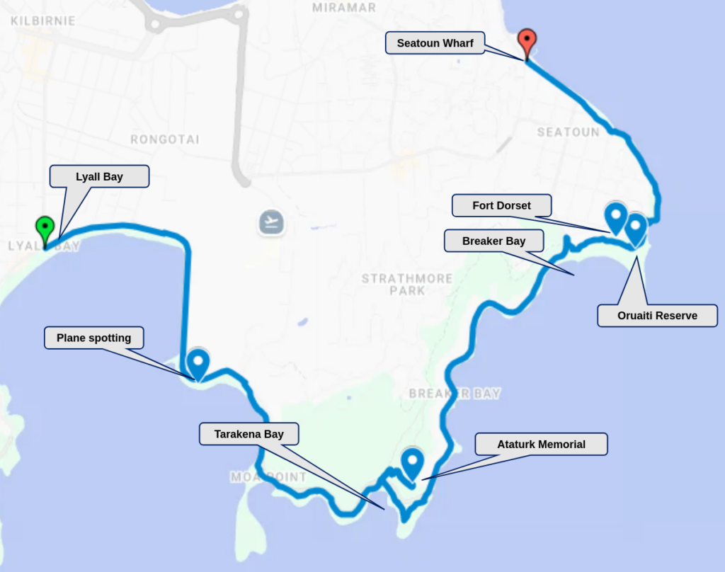

If plane spotting is your thing, then this is the place to get a nice close-up of planes landing and taking off. Can be noisy and smelly though.
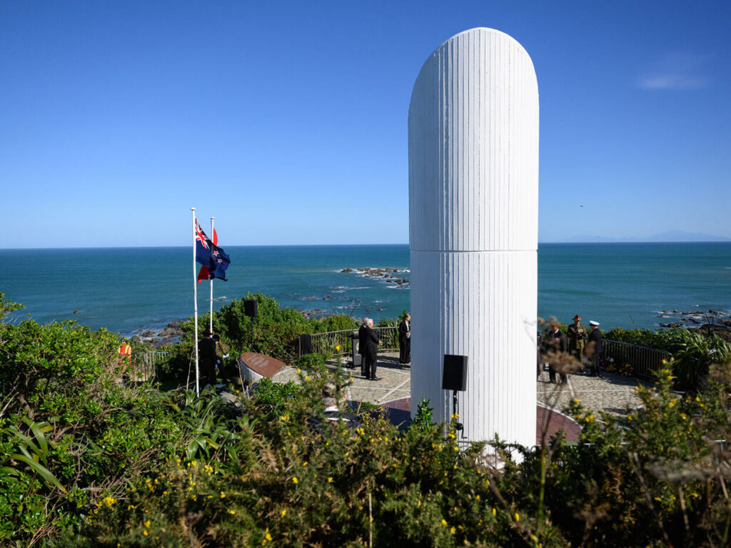
Memorial to Mustafa Kemal Atatürk, the first president of the Republic of Türkiye. It is located on a ridge above Tarakena Bay on the south coast of Wellington.

The Point Dorset and Oruaiti Reserve features a waka sculpture and pouwhenua that mark the historic site of the former Ōruaiti Pā and commemorate the Polynesian explorer Kupe, as well as weathered World War military bunkers from the former Fort Dorset base.

The Wahine Memorial in Seatoun overlooks the entrance to Wellington Harbour where the TEV Wahine tragedy unfolded in 1968 with the loss of 53 lives, making it New Zealand’s biggest maritime disaster.
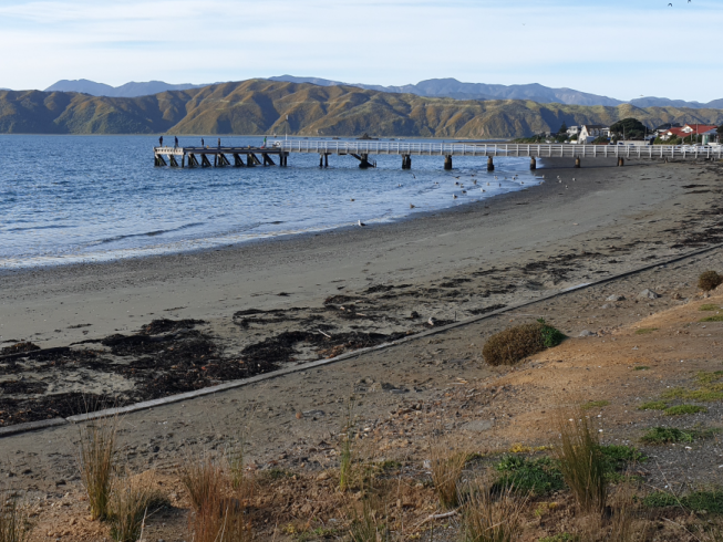
Originally built in 1901, this wharf has been completely refurbished and was re-opened in 2022. It sits along Seatoun Beach, popular for swimming.